Research

Research Interests
Advanced Aerospace Structures
Phased Antenna Arrays
Multifunctional Structures
Airborne Remote Sensing
Unmanned Aircraft Systems
Current Projects
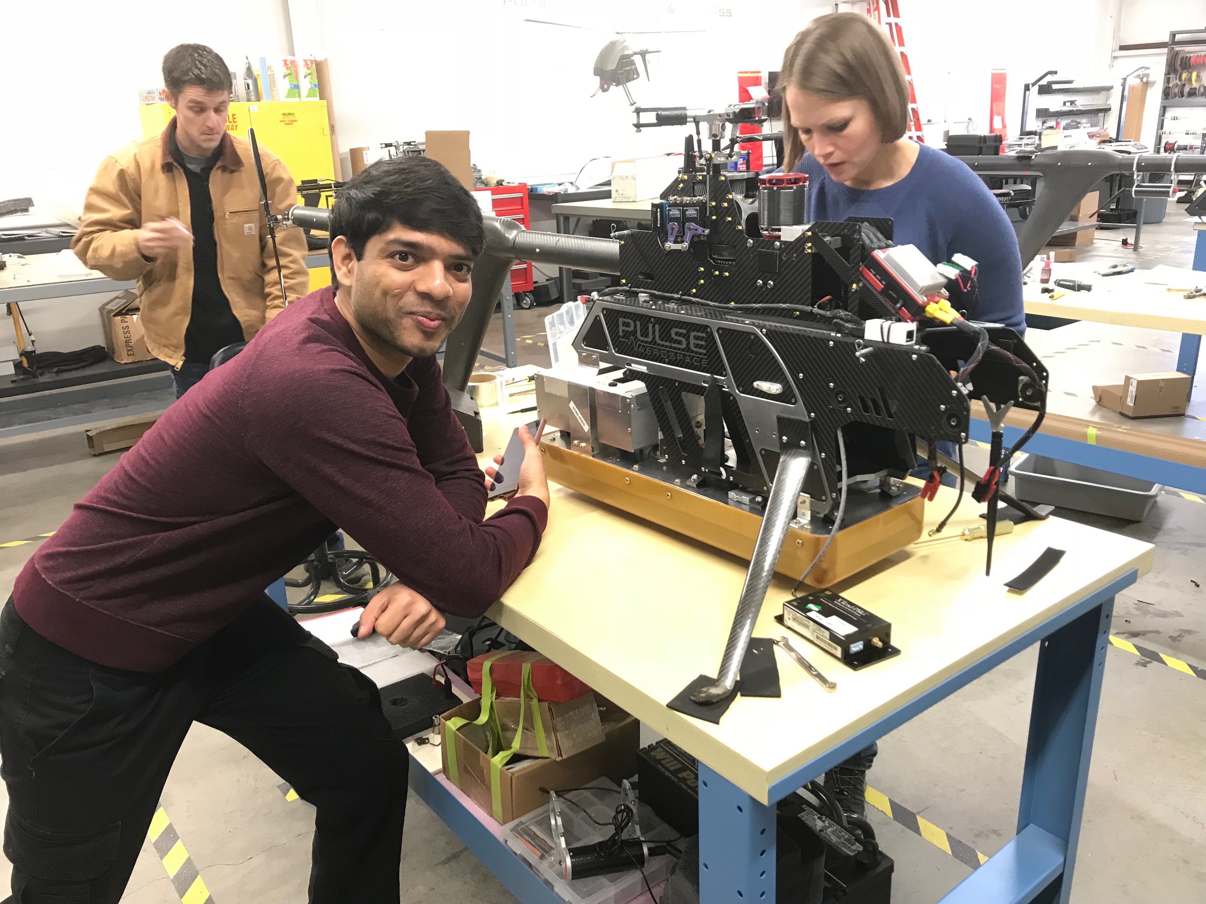
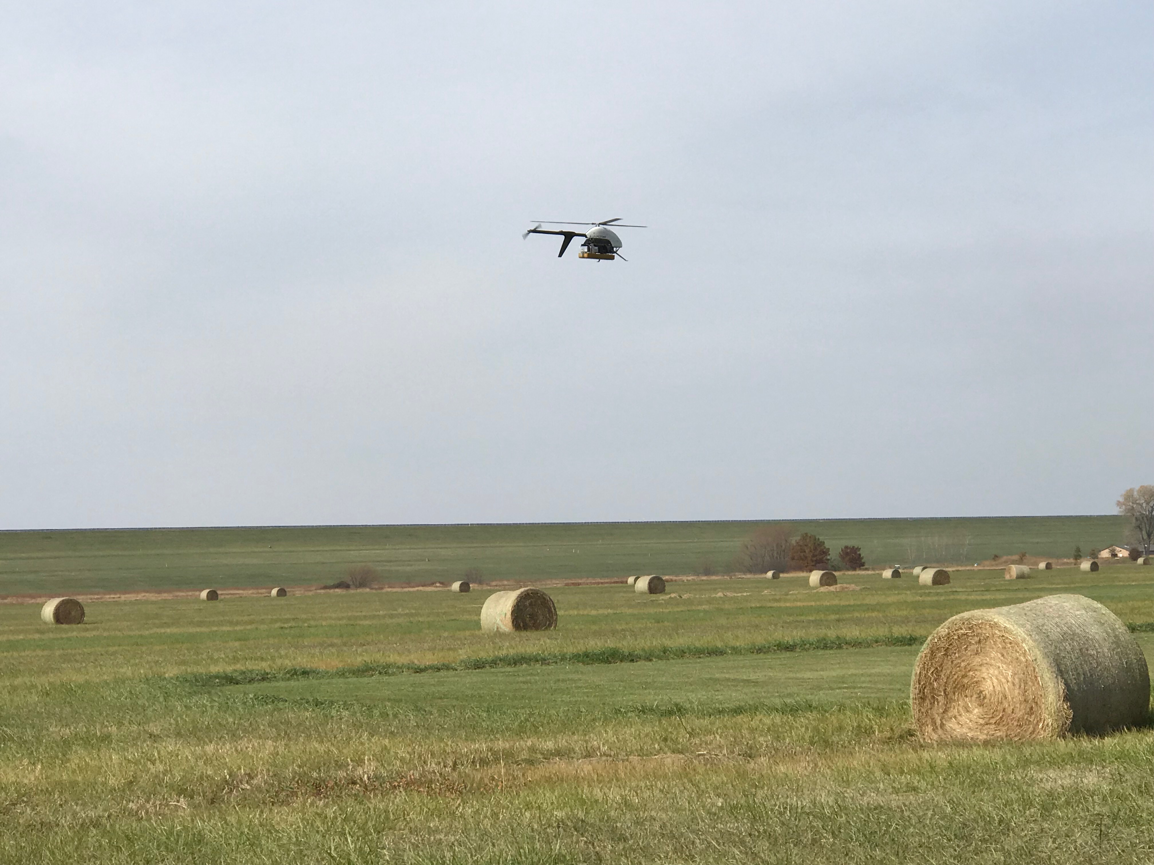
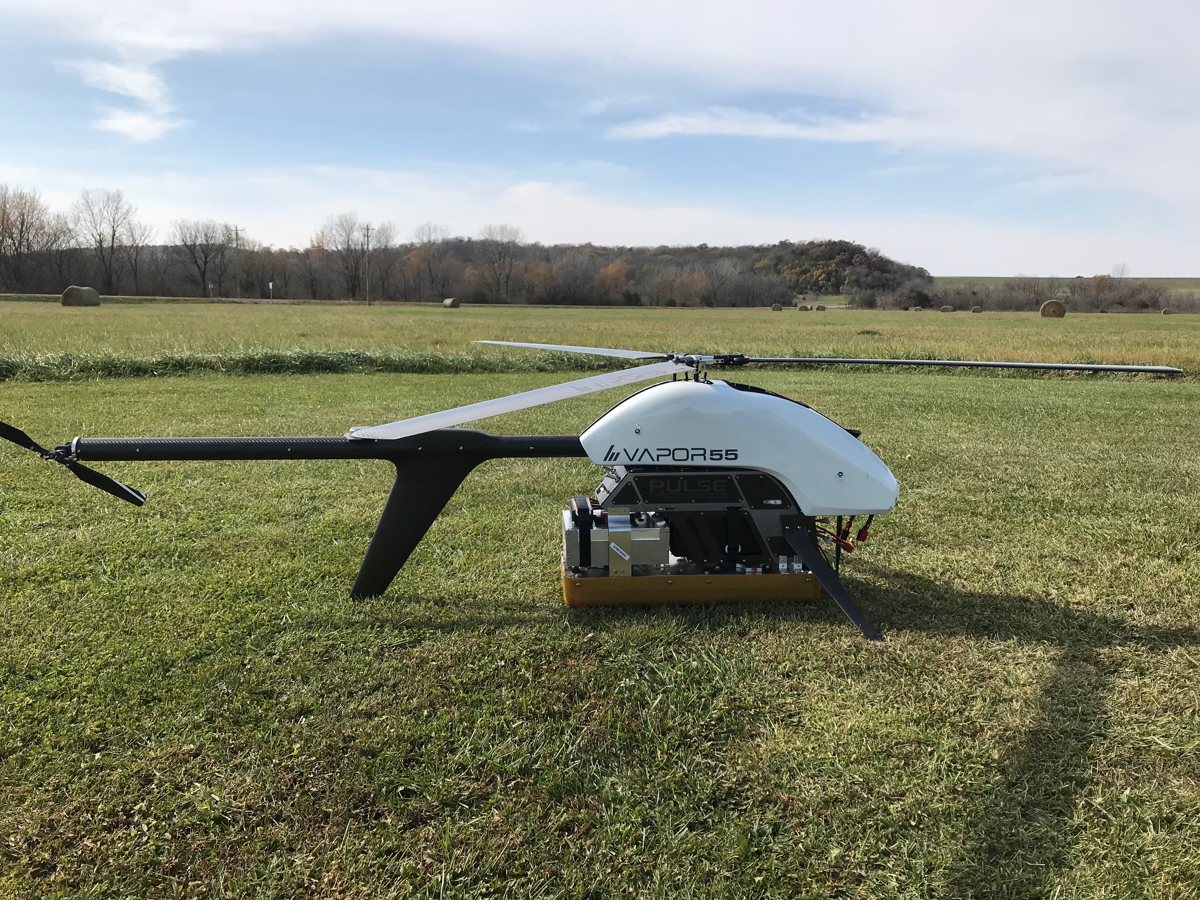
CAREER: UAS-Base Radar Suite for Sounding and Mapping Glaciers
- Summary: We are equipping a UAS helicopter with a radar suite for ice surface and bed measurements to produce fine-resolution data sets. Specifically, we are integrating a 35 MHz ice sounder and an Ultra Wideband (UWB) 2-18 GHz radar on the UAS. The project will enable the routine deployment of a highly capable airborne radar suite without the large logistical support typically required for manned and unmanned fixed-wing field surveys. Our efforts will also provide a tool for glaciologists to use at field locations for quick and efficient radar surveys of ice and snow. We will incorporate aspects of this research in both graduate and undergraduate courses through design-build projects and K-12 outreach programs. The goal of this integrated research and education plan is to 1) develop a remote sensing tool to support a wide range of glaciological process studies related to crevassing and bed topography; 2) train post-secondary students in the development of next-generation remote sensing technologies to better prepare them for 21st century careers; and 3) leverage field and research activities to excite K-12 students about science and engineering.
- Funding Agency: NSF
Airborne Snow Depth Retrieval for Improved Hydrological Modeling
- Summary: We are integrating the 2-8 GHz snow radar onto KUAE’s Cessna 172. During Winter 2020 and 2021, we will collect a variety of airborne radar measurements over a drainage basin in South Dakota for snow depth retrieval and integrate these spatially continuous data sets into a basin-scale model using the WRF-Hydro framework. The first objective of this work is to demonstrate the Snow Radar as a new instrument whose data has utility in current modeling predictions. To accomplish this, we plan to conduct broadband radar measurements over a variety of terrains and vegetative states to demonstrate the radar’s ability to measure snow depth in variable conditions. In addition to demonstrating a variety of measurements to support the retrieval of snow depth, the second objective of the proposed work is to demonstrate the utility of spatially continuous snow depth measurements for seasonal prediction of streamflow.
- Funding Agency: NOAA
Previous Projects
- Adaptation and Demonstration of an UWB Radar for Rotorcraft UAS
- Summary: A 2-18 GHz radar was miniaturized for integration onto a small helicopter UAS. The motivation for this work was to investigate using a UAS-based radar for soil moisture measurements. Custom low profile UWB antenna elements were developed and integrated onto the vehicle in addition to the miniaturized radar electronics.
- Funding Agency: NASA EPSCoR